By Tour Types
By Gateway Cities
By Gateway Cities

5 Days Lhasa & Namtso Lake Group Tour
5 Days Lhasa & Yamdrok Lake Group Tour
6 Days Lhasa & Shigatse Group Tour
7 Days Lhasa to Kathmandu Overland Group Tour
8 Days Everest Base Camp Group Tour
9 Days Lhasa & Everest & Namtso Lake
10 Days Lhasa & Everest & Namtso Lake
14 Days Mt. Kailash Trek & Pilgrimage Group Tour
15 Days Mt. Kailash Trek Group Tour
Tibet Permit & VisaTibet Travel FAQsTibet TrainsTibet FlightsTibet AttractionsTibet HotelsTibet MapsAltitude SicknessWeather & ClimateCustom & Trandition
Tibet ShoppingFood & DinningEtiquettes & TaboosTibetan BuddhismTibetan HistoryCulture & ArtsTibetan FestivalsTibetan MedicineWhat to PackTibetan People

Tingri Overivew
Tingri County is located 100km to the northwest of Mr.Everest Base Camp, situated between the city of Shigatse and Zhangmu County ( China’s border town adjoining Nepal ). It is about 100km to the northwest of Mr.Everest Base Camp, people often choose to stay overnight in Tingri before heading to EBC. As the place which must be passed to Mt. Everest, Tingri is often used as the last base by travelers and climbers refreshing and preparing themselves to ascend Mt. Everest. And in fact, there are two towns in this county for travelers take a break before their adventures, namely Shegar Town ( New Tingri ) and Gangka Town ( Old Tingri ). In Tringri, there are totally 4 mountains which are over 8,000m above the sea level. They are Mt. Everest (8,844.43 m / 17,060 ft), Lhotse (the forth highest mountain in the world, 8,516 m / 27,940 ft), Makalu ( the fifth highest mountain in the world, 8,481 m / 27,825 ft), and Cho Oyu ( the sixth highest mountain in the world 8,201 m / 26,906 ft).

Rongbuk Monastery & Mt.Everest
Tingri History
Tingri got its name from the Tingri Temple in a hill and it used to be an important trading post where Sherpas from Nepal exchanged goods with Tibetan. Tingri was under the government of Tubo Regime in ancient times. The area was controlled by Mongol in 13th Century after Yuan Dynasty merged Tibet to Central China. The county was set up in 1960.

Shigatse to Tringri via Lhatse
The route is usually Lhasa-Shigatse-Tingri-Evrest, then visitors can choose come back to Lhasa or headng to Zhangmu in order to get to Kathmandu
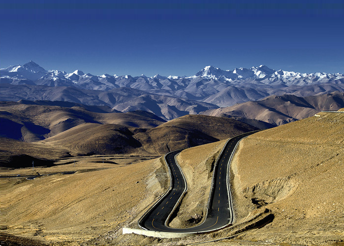
The road from Shigatse to Tingri is a highway officially named Highway No.318, also known as “China Nepal Friendship Road” connecting Lhasa and Kandumandu (passing through Shigatse, Lhatse and Tingri in between). The road distance is 240km which is good road condition, it takes about 3 hours by 4WD, and over 4 hours by bus. During the ride you will pass by Lhatse County and two mountain passes – Tsola Pass (4500m) and Gyatsola (5050m), which offers beautiful views.
From Shigatse to Tringri
The route is usually Lhasa-Shigatse-Tingri-Evrest, then visitors can choose come back to Lhasa or headng to Zhangmu in order to get to Kathmandu
The road from Shigatse to Tingri is a highway officially named Highway No.318, also known as “China Nepal Friendship Road” connecting Lhasa and Kandumandu (passing through Shigatse, Lhatse and Tingri in between). The road distance is 240km which is good road condition, it takes about 3 hours by 4WD, and over 4 hours by bus. During the ride you will pass by Lhatse County and two mountain passes – Tsola Pass (4500m) and Gyatsola (5050m), which offers beautiful views.
Road to Everest
How to get to Mount Everest? There are 3 ways to reach EBC
Trek to Everest Base Camp: People usually trek from Rongbuk Monastery to the EBC. It is only 8 km, but will takes you about 2 hours to reach the Everest Base Camp at the altitude of 5200 m.
Climbing Mount Everest: Climbing Mount Everest is tough and only for experienced mountaineers.
Biking to Everest
Travel Tips
As after 2008 unrest in Tibet, the government regulates that foreign visitors is not allowed to travel independantly in Tibet, all visitor’s stay in Tibet needs to be accompanied by the tour arranged by local travel company. Therefore you have to book a tour with a travel company for the Tibet permits and other arrangements. Plan you Tibet Tour by emailling to our experienced travel experts via the methods below, our experienced team will not only provide the unbeatable rate, but also excellent service standard to make your lifetime Tibet tour more enjoyable.
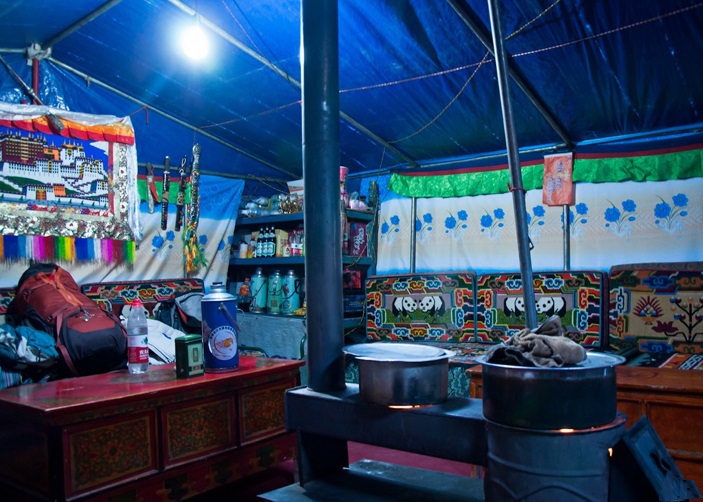
Dorm tent of Rongbuk Monastery
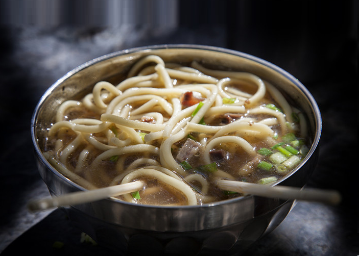
Food at Rongbuk Monastery
Weather in Tingri & Everest; Best time to visit Tingri & Everest
With an altitude of about 4,300 meters, Tingri has a semi-arid monsoon and plateau temperate climate. There is a big temperature difference between day and night. The climate is dry with less rainfall and big moisture evaporation. The area has a deadly monsoon in summer and harsh climate in winter.